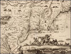
Dutch merchant ships returned from Africa, Asia, and the Americas with the most current navigational and geographical information, and Amsterdam map and chart makers benefited, particularly those, like Willem Blaeu, who held posts within the trading companies that controlled access to this sensitive data. Even after the position of Amsterdam’s printers began to weaken in the 1670s, the reputation of their charts persisted—despite the sometimes dated aspects of their wares. For many foreign ports, they remained the only charts available.
Explore Information Is Power
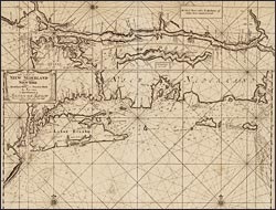
Pas-kaart vande zee kusten van Niew Nederland ...
This important map combines three navigational charts detailing the Atlantic coast from New Jersey to Cape Cod, and the courses of the Hudson and Connecticut rivers. It was originally published by Willem Blaeu and reissued by two other firms before being re-engraved by van Keulen for inclusion in his sea atlas. It represents the accumulated knowledge of Dutch pilots, who carefully mapped the potentially hazardous depths of river channels and off-shore waters by dropping a calibrated, leaded line overboard at measured intervals.

